Tracking world's largest animals
If you were tasked with finding and tracking a 25-meter long object, you could probably apply your Electrical Engineering skills to devise a range of different methods. Whilst these methods might work on land, applying them to an aquatic environment causes problems. Conventional techniques - involving the transmission of (RF-)signals - are quickly eliminated by the attenuating properties of water (at roughly 9dB/mm [1]). This is a major problem for marine biologists who seek to track marine animals and their migration movements.
High in the sky
Fortunately, there are aquatic animals that fit the ‘25-meter long object’ description, namely the blue whale. With the largest specimen measuring a 27.6 meters [2], it is an significantly large animal which also significantly simplifies tracking. The WorldView-3 satellite from the British Antarctic Survey (BAS), which was actually applied for whale-tracking, can manage a (panchromatic) resolution of 31cm [3] making these large whales ‘easily’ recognisable in pictures from space. Naturally, covering an area of 5000km2 is not an easy feat. Finding slightly darker spots on the ocean’s surface is not easy, but doable nonetheless.
Currently, resolution in imaging from space is limited by legislation, not necessarily technology. The tracking herds of animals and the tracking of armies can be considered quite similar, which is something the world’s largest powers dislike. Hence, promising techniques, such as Short Wave Infra-Red (SWIR), can unfortunately not be performed in the highest resolution.
Acoustic observations
Whale observations are also possible from earth’s surface however. Being marine biologists, the researchers want to stay close to their field of research and often reside on boats to perform observations. As it so happens, whales can also be spotted from on-top of these research vessels. Sightings could be used for population counts, but are not a very efficient method. Hence, it is often used in conjunction with different techniques such as acoustic measurements, which record acoustic calls from the whales. These are performed using hydrophones (basically underwater microphones) and validated using the manual sightings. The hydrophones can be placed in an array, enabling the opportunity to perform beamforming in the same way one would using antennae, to perform more accurate directional measurements. This technique is promising, but limited to the vicinity of the research vessel. Therefore, it is (nearly) impossible to observe the entire ocean.
Global positioning
Wouldn’t it be great to observe these animals from a distance such that you don’t have to be close with your boat? Sure, there is an engineering solution for that. It comes in the form of the Argos project which originates from the end of the seventies, but is still the most used system for this purpose. In contrast to GPS-systems which need three (but preferably four) satellites to ‘trilaterate’ an object, the Argos systems uses only one. To provide a position within 150 metres accurate [5], the Argos system makes use of the Doppler shift of the signal received at the satellite. It takes a number of measurements as it orbits earth’s surface and measures the frequency of the signal. Since the satellite is moving, the perceived frequency will be varying between measurements. With this data, the object can be localised.
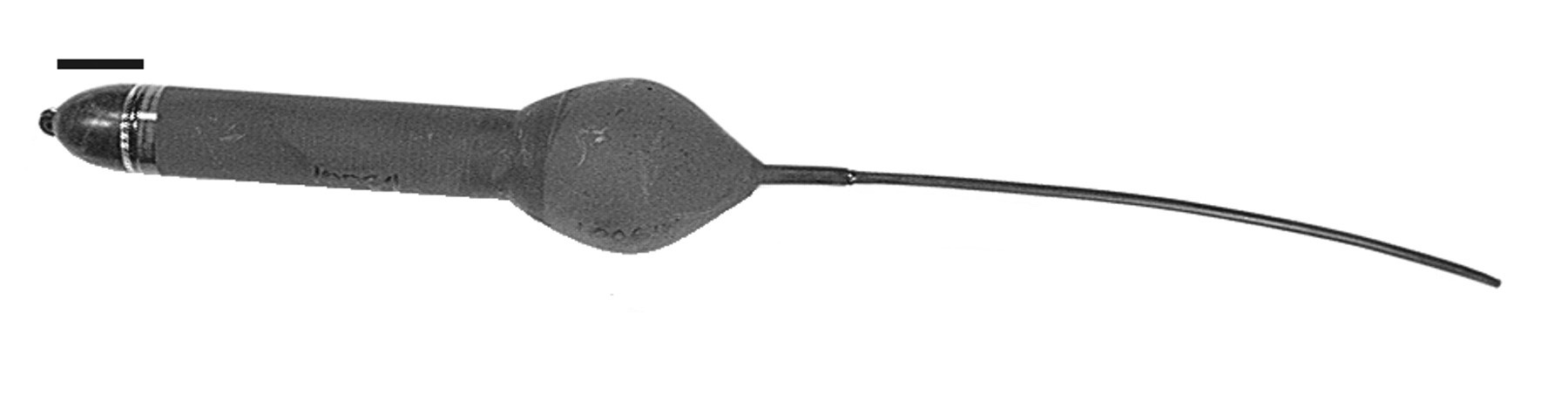
As mentioned before, the attenuation of water throws a spanner in the works of this plan. When the whales are deep below the surface, no signals can be sent or received. Therefore, the so-called pop-up satellite archival tags (PSATs) were created. They can log a variety of different variables (such as: temperature, magnetics, acceleration, light level, oxygen levels and pressure) and transmit them using the Argos system when the tag is at the surface.
Unfortunately, the tags cannot send transmissions when submerged, so localisation cannot be done using Argos’ Doppler technique. Instead, an estimation of the position is based on light and magnetic fields. The tag measures the time it receives light to determine the length of a day. The length of a day can then be matched to a latitudinal position with an accuracy of 1 degree, or approximately 111 kilometres. This method is based on light that penetrates water. In colder areas where plankton (krill feeds on plankton and whales feed on krill, so the areas where whales live) is more abundant in the water it is difficult for light to penetrate deep into the ocean.
Luckily, there are two major factors ‘keeping the whales afloat’, namely their need to breath at the surface and their source of food, the krill, which live at a depth of around 100 metres. Hence this method is viable for our blue whales. Alternatively, for species that live deeper down in the ocean, the tag could measure the magnetic field of the earth to determine it’s approximate latitudinal position by contrasting it to a known map of earth’s magnetic field. This is accurate to within 65km, so significantly better than the light-based method.
Using the light data, and after deriving the length of a day, the average time can be determined. This is set as the noon-time. Using the noon time, it is possible to make an estimate of the longitudinal position. Thus creating a complete position of both latitude and longitude, which can be transmitted at the earliest opportunity when the tag reaches to ocean’s surface.
Whale tracking seems to be a hot-topic for marine biologists, but for Electrical Engineers more so. Research of marine biologists is based on the measurements made with the different tools that are available to them. By increasing accuracy of instruments across the field, it becomes easier and cheaper to track whales.
References
[1]: Gergnot, C. (2007), GPS signal disturbances by water in various states, Proceedings of the ION GNSS, September 25–28, Fort Worth, Tex.
[2]: Guinness World Records, “Largest mammal”, http://www.guinnessworldrecords.com/world-records/largest-mammal, accessed on: 10-03-2019
[3]: Satellite Imaging Corp., WorldView-3 Satellite Sensor, https://www.satimagingcorp.com/satellite-sensors/worldview-3/, accessed on: 10-03-2019
[4]: H. C. Cubaynes, P. T. Fretwell, C. Bamford, L. Gerrish, and J. A. Jackson, “Whales from space: Four mysticete species described using new VHR satellite imagery,” Marine Mammal Science, Oct. 2018.
[5]: Argos systems, “What is the accuracy of Doppler locations?”, http://www.argos-system.org/faq/what-is-the-accuracy-of-doppler-locations/, accessed on: 10-03-2019
[6]: B. A. Block, H. Dewar, C. Farwell, and E. D. Prince, ‘A new satellite technology for tracking the movements of Atlantic bluefin tuna’, Proceedings of the National Academy of Sciences, vol. 95, no. 16, pp. 9384–9389, Aug. 1998.